Drone
Aerial surveys using Photogrammetry and LiDAR
Services
Acquisition of aerial images
We are skilled in Cartography with recourse to UAV's (Unmanned Aerial Vehicles - UAV). Drone ), using Photogrammetry photogrammetric techniques, through the collection of high resolution photogrammetric restitution e ortho-rectification the same, as well as the georeferencing by GNSS GNSS SYSTEMS from various types of aircraft (airplane and helicopter), equipped with the most diverse sensors : LiDAR, Multi-spectral cameras, RGB e Thermal .
Solutions
Topographic Cartography
Cadastral Cartography
Thematic Cartography
Orthophoto maps
Inspection of high voltage power lines
Digital Models

Working Methodology
Aerophotogrammetric and LiDAR surveys
We guarantee the creation of representations that are faithful to reality, supported by high quality equipment and a team highly qualified in cartographic processes, respecting the standards and legislation in force
Data collection
Georeferencing
Processing
Point cloud
Orthophoto maps
Digital Terrain Models (DEM)
3D models / BIM
Advantages
We create maps, draw up plans and/or updatethem

Topographic Cartography
We produce cartographic information of a region at various scales, approved cartography, land use/urban planning

Orthopho maps
We have equipment and software of excellence that allow us to obtain aerial photographs and/or point clouds in order to obtain digital orthophotomaps and high quality 3D models quickly and affordably, ensuring direct integration in a GIS

Thematic Cartography
We provide geo-referenced information of the study area mainly for cartographic production in risk environments such as mining, construction zones, cliffs, and other remote areas

Digital Models
We make Digital Terrain Models(DEM), Surface Models(SDM) or Elevation Models (ESM) using various types of three-dimensional geographic information on relief, vegetation, communication routes, ensuring efficient territorial management and classification for various engineering and land-use planning projects
Application
Sectors of Activity
We guarantee highly accurate and accessible geospatial data mapping
Transport and Infrastructure
Heritage and Archaeology
Network Management
Mines and Quarries
We combine technology with specialised technicians that guarantee excellent results
We have the cartographic techniques and equipment to carry out international level projects, which allows an increase in productivity, simultaneously, at accessible values
Equipment
+ More details
- RIEGL VUX 1
- EBEE
- PHANTOM PRO 4
Team
+ More details
- Engineer / Geographer
Project coordination - Cartography Technician
Preparation and execution of the dynamic acquisition project and carrying out field surveys - Processing Technician
orthoimagery processing
Processing and optimisation of 3D point clouds - Drawing Technician
Vectorisation on ortophotomaps and 3D point clouds
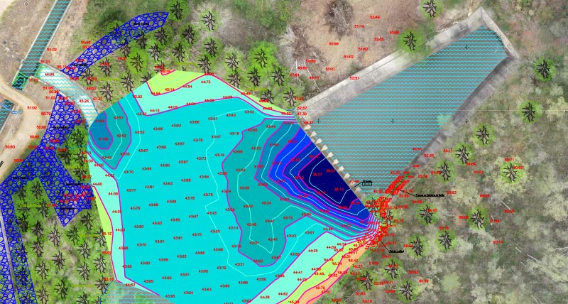
Bathymetry by drone
Water drones
The water drone emerged as a response to a need that work taking place on the bathymetric had already identified.
This equipment, developed by the Research and Development Department of VIAMAPA - GEOSAT Group, is remotely controlled and allows underwater prospection.


Technology
Latest generation
It is particularly crucial and extremely useful in situations where other vessels have more difficulty or cannot obtain the necessary information.
Using the aquatic drone, it is possible to collect data in environments that are difficult to access, such as shallow waters, circumstances where algae and similar occur.


