

Levantamentos 3D de Estruturas e Património
Levantamento Arquitetónico / Modelação 3D
Serviços
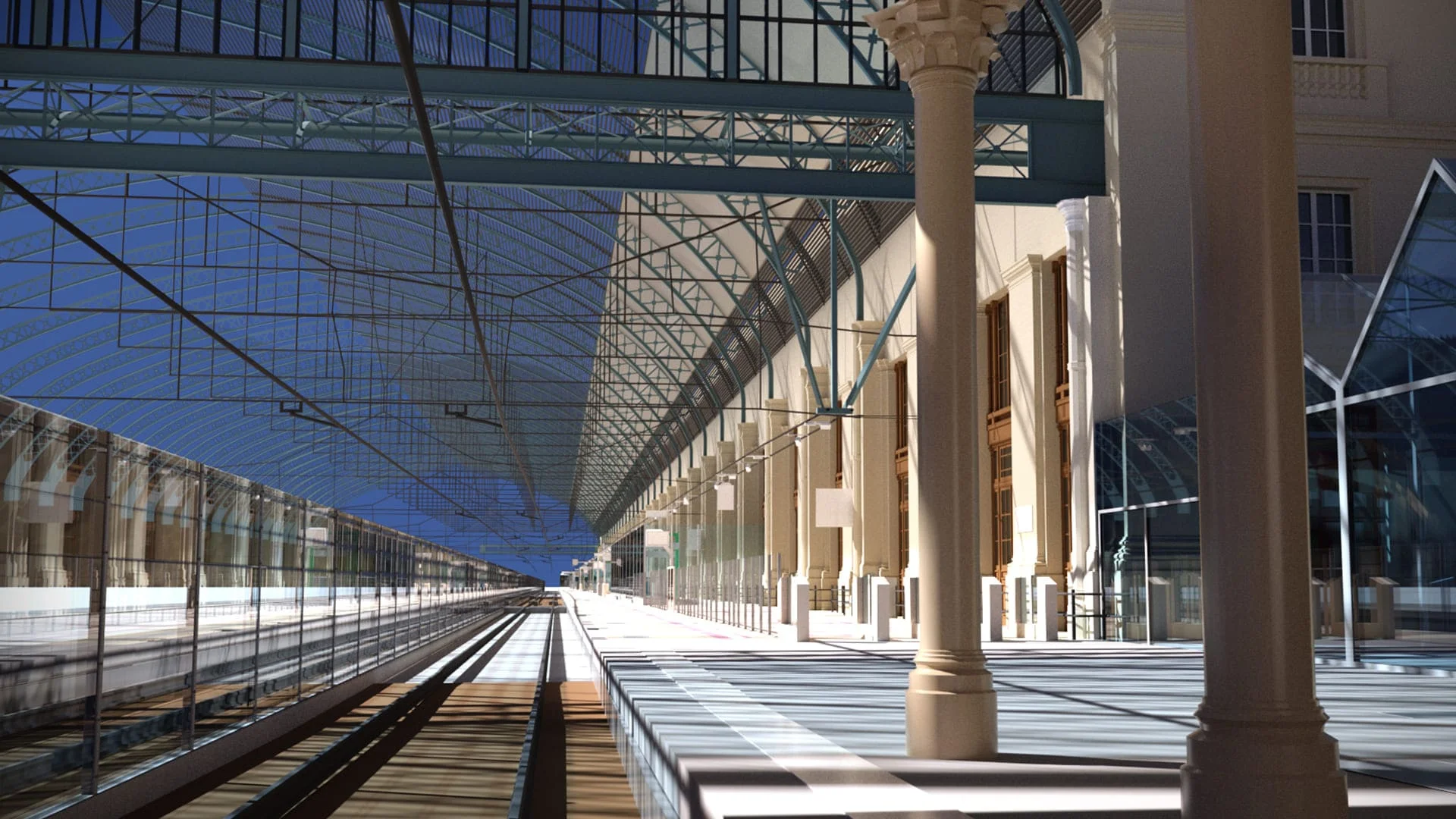
Digitalização 3D de alta definição
O Laser Scanner é um dos equipamentos mais avançados do mercado na recolha detalhada de dados com precisão milimétrica, através de técnicas de varrimento que formam nuvens de pontos possíveis de serem visualizadas em ambiente digital, permitindo a criação de modelos e manipulação 3D, de visitas virtuais (realidade virtual / aumentada / mista) em zonas inacessíveis e de risco
Soluções
Levantamentos as build
Scan e modelação 3D
Fotogrametria terrestre
Gestão de projetos BIM
Realidade Virtual / Aumentada / Mista e Vídeo 360°
Metodologia de trabalho
Garantimos uma representação 3D precisa, de definição superior e adaptável
Realizamos medições tridimensionais de elementos e estruturas complexas com elevado grau de precisão atendendo, também, aos valores RGB das imagens captadas. A informação recolhida permite-nos criar ou extrair de forma automática ou semiautomática :
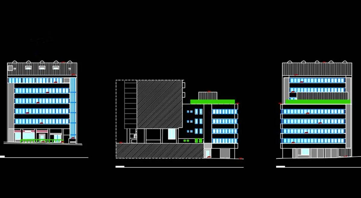
Plantas, alçados e cortes
Representação Arquitetónica
Modelos 3D
Modelo de volumetria
Integração com software CAD / BIM

Aplicação
Setores de Atividade
Costruímos ambientes tridimensionais com elevado detalhe e precisão uma vez que a densidade e a coloração real dos pontos parecem ser imagens e fotos reais em diferentes formatos como vetorial, malhas, raster ou sólidos em ambientes AutoCAD ou BIM
Transportes e Infraestruturas
Construção Civil
Património e Arqueologia
Gestão de Redes
Minas e Pedreiras
Ambientes Industriais
Tecnologia de topo
Laser Scanners e suas vantagens
Aquisição de dados rápida e segura
Ao recolher informações geométricas complexas, garantimos a abrangência integral no levantamento devido à precisão do equipamento Laser com o intuito de realizar a modelação 3D
Medição à distância
O scanner 3D possibilita a reconstrução com elevado nível de precisão e detalhe, em nuvem de pontos, de qualquer tipo de infraestrutura existente, incluindo em zonas de difícil acesso, de risco ou perigosas
Custos otimizados
Redução de tempo de execução em campo em relação aos métodos convencionais

Aliamos tecnologia a técnicos especializados que garantem resultados de excelência
O Laser Scanner possui, como principal vantagem, a aquisição de dados e o alto nível de precisão de interiores e exteriores aumentando assim a produtividade em todas as fases de obra (projeto, exploração e monitorização)
Equipamentos
+ detalhes
- FARO Focus 3D S120
- Pegasus Backpack
- BLK 360 LS
- BLK2GO
- RIEGEL VUX1
- HDS 7000
Equipa
+ detalhes
- Engenheiro/Geógrafo/Arquiteto
Coordenação de projeto - Topógrafo
Levantamento arquitetónico - Técnico de processamento
Tratamento de dados adquiridos em campo - Técnico de Desenho
Representação gráfica de plantas, alçados e cortes
Outras opções
Mapear com recurso a RIEGL e BLK2GO

RIEGL – Mapeamento 3 em 1
Compacto e de elevada precisão que garante nuvens de pontos de alta densidade. O sistema pode ser acoplado a três tipos de veículos: terrestres, aquáticos e aéreos

BLK2GO
Sistema de aquisição dinâmico com três câmaras panorâmicas, SLAM visual e SLAM LiDAR, permitindo melhoria de desempenho e maior rapidez na obtenção de grande volume de informação de campo de forma fidedigna
Veja outros serviços

Mobile Mapping

Cartografia

Cadastro

Topografia
