
In its constant search for innovative solutions that boost efficiency in the implementation of photovoltaic and wind farms, VIAMAPA stands out as a company committed to transforming the renewable energy paradigm.
VIAMAPA, through LiDAR technology, has played a crucial role in optimizing projects and promoting a greener and more sustainable future.
Precision surveying with LiDAR technology
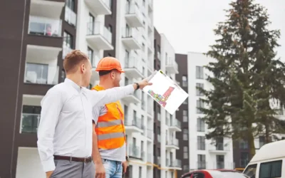
VIAMAPA uses LiDAR technology to carry out detailed surveys, providing essential data for optimizing projects and identifying the most favourable areas. The ability to penetrate vegetation from multi-ecos allows the identification of natural terrain, helping to maximize the efficiency of future parks. This approach not only contributes to precision, but also results in time savings and, essentially, a greater return on investment for VIAMAPA's partners.
Sustainability in every project
In addition to its surveying expertise, VIAMAPA is committed to sustainability. Each project embraced by the company reflects this behavior, contributing to a greener and more sustainable future. By combining technical knowledge with an eco-conscious vision, VIAMAPA stands out as a partner in the environmental cause.

Full process support
VIAMAPA's work is not limited to LiDAR surveys.
The company also provides comprehensive support in the critical stages of maintenance and/or removal of vegetation cover, and in the topographical implementation of the structures. This demonstrates VIAMAPA's approach to excellence in renewable energy projects, which is present throughout the process.
Strategic partnerships for a sustainable future
For those looking for strategic partnerships that combine surveying expertise, cutting-edge technology and drive innovation and sustainability in renewable energies, VIAMAPA is a solution to consider in order to participate in the future of clean energy.
Conclusion
In a scenario where sustainability and innovation are essential, VIAMAPA is positioning itself as a driving force in the revolution of surveying renewable energy parks. The integration of LiDAR technology and a commitment to sustainability puts the company at the forefront of the sector, shaping a future where energy efficiency goes hand in hand with environmental preservation. VIAMAPA is ready to help chart the path towards a cleaner, more sustainable planet.
Ask for your evaluation now and be part of this trip!