
In the Portuguese real estate scene, land registration is crucial to ensuring clear and legal ownership of land. The Balcão Único do Prédio, better known as BUPi, has revolutionized this process by simplifying and making accessible the land registry throughout the country. To ensure the correct georeferencing and measurement of land, specialized services such as those offered by Viamapa play a key role.
In this article, we will explore how to cadastral survey and land registration using BUPi, the benefits of this process and how Viamapa can make the whole procedure easier for you. If you are a property owner in Portugal or involved in municipal management, understanding this process is essential to protecting your property rights effectively and transparently.
Viamapa is currently working with BUPi in the municipalities of Ponte de Lima, Pombal and Arganil.
What is BUPi and how does the Simplified Land Registry work?
BUPi (Balcão Único do Prédio) is a platform aimed at owners of rustic and mixed properties, which makes it possible to map, understand and value Portuguese territory, simply and free of charge. It began in 2017 as a pilot project in 10 municipalities. Following its success, it is now being expanded throughout the country.

Benefits of BUPi for landowners
Registering properties with BUPi ensures that the owner is legally recognized, eliminating doubts and disputes over ownership.
The way to prove that a property belongs to the owner is to register it with the Land Registry, since the main purpose of land registration is to publicize the legal status of buildings, ensuring the security of legal commerce.
The Land Registry publicizes property rights and their owners.
The inscription of buildings on the matrix only has tax effects and does not guarantee any ownership rights.
Buildings that are not identified through the georeferenced graphic representation procedure are subject to the public consultation procedure.
How much does a Georeferenced Graphic Representation cost on BUPi?
The identification of the location of properties, through the georeferenced graphic representation procedure, is always free of charge when done online at BUPi or at a physical BUPi branch on December 31, 2025.
Legal basis: Article 14(1)(e) of Law no. 65/2019, of August 23, in its current wording, and Article 16 of Decree-Law no. 90/2023, of October 11.
Steps to successfully register with BUPi
The first step is to geo-reference your properties on BUPi. To do this, and if you are an emigrant, when you return to Portugal, go to the BUPi Counter at the Town Hall of the municipality where the land is located or you can start the process online via the BUPi website.
On a counter

If you prefer to carry out the process in person, you must:
- Go to the BUPi Counter, taking with you your Citizen's Card and the Caderneta Predial with the number of the property's matrices to be georeferenced. Alternatively, you can indicate the matrix number and NIF so that the technician can consult the Caderneta Predial on the Finance Portal. If you have already done a topographic survey or identified the boundaries of your properties using the BUPiApp, you should take the file with the GPS coordinates with you;
- Together with the BUPi Qualified Technician, identify your property on the map on the BUPi platform;
- Finally, sign the disclaimer.
In this case, if the property is not registered with the Land Registry, you must go to the Land Registry to register it. If the property is registered, the georeferencing process is completed automatically in BUPi.
In the BUPi App

If you want to start the process online, follow these steps:
- Go to the BUPi website- BUPi.gov.pt - and take your Citizen's Card and the Caderneta Predial with the number of the matrices to be georeferenced;
- Then log in to the BUPi platform with your Citizen Card or Digital Mobile Key (find out more about CMD - here). here);
- Fill in a brief form and locate your properties on the map or, alternatively, upload a file with their GPS coordinates, which you can obtain with the help of the BUPi App;
- Next, sign the disclaimer that is generated by the platform and submit it signed by the same means;
- Finally, wait for the validation of the sketch created on the platform by the Qualified Technician of the municipality where you own your properties.
Once the sketch has been validated, you should go to the Land Registry Office, which will already have all the information about the location and boundaries of the property, in order to register it. If the property is already registered, the georeferencing process is completed automatically in BUPi.
Documentation required to start the BUPi registration process

Mandatory documents:
- Citizen Card (or Identity Card and NIF);
- Caderneta predial with the number of the matrices or information for consultation on the Finance Portal;
- If the interested party is represented - Simplified power of attorney model BUPi or formal power of attorney proving the legitimacy of the promoter to initiate the RGG procedure.
Optional documents:
- Topographical survey, if the promoter has previously surveyed the coordinates;
- Document proving ownership, if any, or model_IRN form to justify the registration request.
How Viamapa facilitates the process of registering your building with BUPi
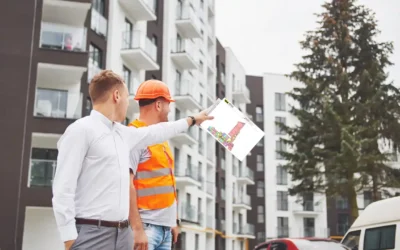
With years of experience, Viamapa offers specialized support and advanced technology to carry out detailed topographical surveys, essential for the correct georeferencing of your land and to ensure that the boundaries of your buildings are accurate, which will facilitate the correct identification, location and registration on the BUPi platform efficiently and without complications.
Contact Viamapa for topographic surveys throughout the country.
For more information about our surveying and georeferencing services in Portugal, please contact us via our website www.viamapa.com. We are here to help you ensure security and clarity about the ownership of your property. Contact us !