

Topography, Cartography, Bathymetry, Cadastre and GIS Services
Viamapa specializes in Topographic Engineering, Cartography, Geodesy and Hydrography, offering precision solutions for engineering, architecture and construction projects, both nationally and internationally.. Contact us!
years
surveying, modeling and 3D measurement
We are a company company reference e we operate in all o territory territory e international, participating in public public e markets.
Surveys
We carry outsurveys surveys/bathymetric / architectural/3D for projects architectural architecture, support à construction, mining/quarries e engineering.
Property registration
We guarantee a accuracy e constant records real records, including marking e staking on the ..
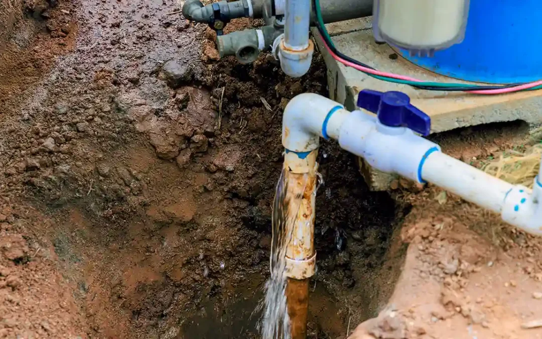
Infrastructure Register
We map the soil and subsoil to detect e identify various types of networks(water, sanitation, electricity, gas, fiber) in a non-intrusive way. non-intrusive.
Mapped Cities
We flew over a vast area with using a various platforms platforms platforms for the creating maps, plans and/or their updating.
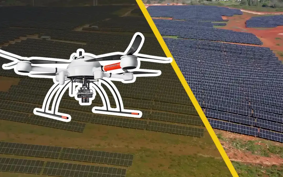
Renewable Energy
We contribute to the progress of renewable energy( solar solar, photovoltaic e wind farms).
Services
Our topography, cartography, bathymetry and cadastre services provide essential information for the planning and execution of your projects, promoting success at every stage.
Projects | Some success stories
Viamapa has been mastering laser scanning(LiDAR) Fixed (on a tripod), Mobile (handheld, backpack or vehicle) and Aerial(drones and aircraft) technologies for several years.


Do you need to talk to a specialist?
We offer a wide range of services, including topography, surveyingGPS, georeferencing and cadastral surveyingcartography, GIS, bathymetry, cadastres, etc. Contact us!

Performance and Solutions Portugal, Spain, France, Mozambique
Areas of Intervention
We rely on the know-how of specialized teams and state-of-the-art technologies to guarantee solutions in different areas: Topography, Architecture, Construction Projects, Cartography, Archaeology, Municipalities, Real Estate Developers, Structural Monitoring and Engineering Services.
Transport and Infrastructure
Building and Construction
Network Management
Heritage and Archaeology
Mines and Quarries
Industrial Environments
Contact us
Contact us
Frequently asked questions
How much does it cost to do a topographic survey?
The cost of a topographic survey varies depending on the complexity of the terrain, the extent of the area to be surveyed and the type of survey required.
Who measures the land?
Land is measured by surveyors. These professionals use tools such as theodolites, total stations and GPS to obtain precise measurements of the terrain.
What is a building survey?
Property surveying is a process that involves accurately measuring the dimensions, boundaries and physical characteristics of a property. This survey is essential for ensuring legal compliance and for planning construction or renovation work.
Who can do land surveying?
The topographic survey must be carried out by a qualified surveyor. These professionals have specific training in topography and use specialized equipment to guarantee accurate measurements.
How long does it take to do a topographic survey?
The time needed to carry out a topographic survey depends on the size and complexity of the terrain, as well as the type of survey. It can vary from a few hours for small areas to several weeks for large complex plots.
What is the difference between surveying and georeferencing?
The main difference between surveying and georeferencing is that surveying focuses on on measuring and representing the physical characteristics of a piece of land, while georeferencing assigns geographical coordinates to specific points on the ground, allowing them to be located exactly in a global coordinate system.
Who are surveyors?
Surveyors are professionals who specialize in measuring and mapping land. They are trained in topography and use advanced technologies to provide accurate data essential for construction, urban development and agricultural planning.
What is a topographic survey?
A topographic survey is the process of measuring and mapping the physical characteristics of a piece of land. This procedure is essential for construction, agriculture and urban development, as it provides accurate data on the shape, size and location of natural and artificial elements.
What are the types of surveying?
There are several types of surveying, including:
- Planimetric SurveyFocuses on measuring horizontal features of the land, such as property boundaries and the location of structures.
- Survey AltimetricConcentrates on measuring the elevations and contours of the terrain.
- Planialtimetric surveyCombines planimetric and altimetric measurements, providing a detailed map of the horizontal and vertical characteristics of the terrain.
- Cadastral surveyUsed to define and record property boundaries.
- Geodetic Geodetic Survey: Uses geographic coordinates to map large areas with high precision.